![]()


|
|
More Devonian Maps
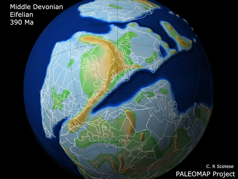
This paleoglobe of the Middle Devonian shows the closure of the Iapetus Ocean during the first stages in the formation of Pangea. The white outlines represent present-day coastlines and political boundaries. The tan-colored mountain range that runs through eastern Greenland, Scandinavia, and New England resulted from the collision of Baltica and Laurenia. Land connections between the northern continents and Gondwana were beginning to be established. Freshwater fish from Gondwana migrated northward into North America.
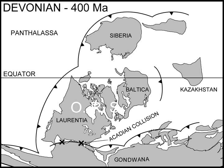
This map of the Early Devonian shows:
|