 Return Home The
Next Generation of Paleogeographic Maps
Return Home The
Next Generation of Paleogeographic Maps
Return Home The
Next Generation of Paleogeographic Maps
3D Paleotopographic and Paleobathymetric Models
![]()
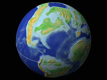
Late Cretaceous (Campanian, 80 mya) with 3D Paleogeography & Paleoclimate (View Animation)
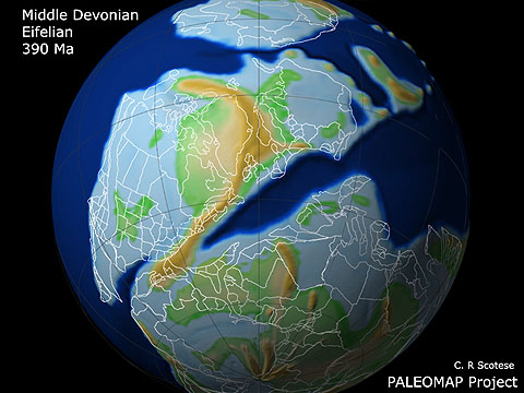
Middle Devonian (Eifelian, 390 Ma) with 3D Paleogeography & Modern Coastlines

Early Permian (280 mya) with Paleotopography (View
Animation)
3D Paleotopography and
Paleobathymetry
The 3D globes shown above were rendered using new digital topographic and bathymetric data sets that model paleo-elevation and paleo-bathymetry. These digital datasets have a spatial resolution of less than 1/10 of a degree and a vertical resolution of approximately 40 meters.
For information concerning the availability of these data sets contact as at: chris@scotese.com